|
 Title:
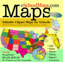
eSchoolMaps: Editable Clipart Maps for Schools Title:
eSchoolMaps: Editable Clipart Maps for Schools
Reviewed By:
Jackie D. Igafo-Te'o
Review Date: April 29, 2006
Price:
$39.95 (includes a complete collection of editable state, USA,
country, regional and world maps in a variety of formats on
CD-ROM for worksheets, lesson plans, school and web projects for
teaches and students)
Description:
eSchoolMaps offers a large collection of clipart maps that
can be customized and edited for education use. Our outline
maps, which are available on CD-ROM, are an ideal teaching tool
for any grade level. Available in PowerPoint and EPS Adobe
Illustrator formats, our maps can be tailored for student
worksheets, classroom lessons and group projects. We provide a
full range of maps, including: the United States, North America,
world regions, world projections and many individual countries.
Each state and country in every map is an individual element,
allowing users to modify the image for specific assignments.
Using PowerPoint or Illustrator, students and teachers can
select states or countries, pull out sections, color, insert or
delete text, draw lines and boxes or add color to highlight
specific areas. Maps are royalty free for print and electronic
use. Our collection also includes an extensive number of JPG and
GIF maps, which are perfect for student reports, projects and
web sites. These maps include world projections, world regions
and more than 200 country maps and flags.
Jackie's
Review: Upon hearing of this new cd-rom, I was very
excited to try it out. Being a former state grantee working in
Michigan's Early Intervention program and then again with
Michigan's Parent Training project, I found one thing to be
true: there was quite a shortage of customizable maps. I
was always "stuck" with the creator's fonts, colors, or regions.
Since trying Bruce Jones' map collection, I can honestly say
that I'll never have that problem again. My map search is
finally over! Using eSchoolMaps extensive library on
cd-rom, users can separate or "pull out" pieces of maps, color
and customize states, countries or regions, change fonts,
resize...you name it. The (PC Windows and Mac
compatible) cd-rom includes maps in many formats: PowerPoint,
EPS, JPG, BMP and GIF. Maps include USA, states, world,
globes, regions, countries, and CIA World Fact Book maps and
flags. No classroom should be without this collection.
Students will be delighted to find that this cd-rom contains
virtually every map they'll ever need for class projects and
homework requirements. I would recommend this product to
any educator or parent that has a student whose studies require
the use of maps.
About the Author: Bruce Jones Design, Inc. is a graphic
design firm specializing in business and education graphics
since 1985. They offer downloadable and CD-ROM map collections.
back to the top ~
back to Breaking News
~ back to
What's New
|